Our Equipment
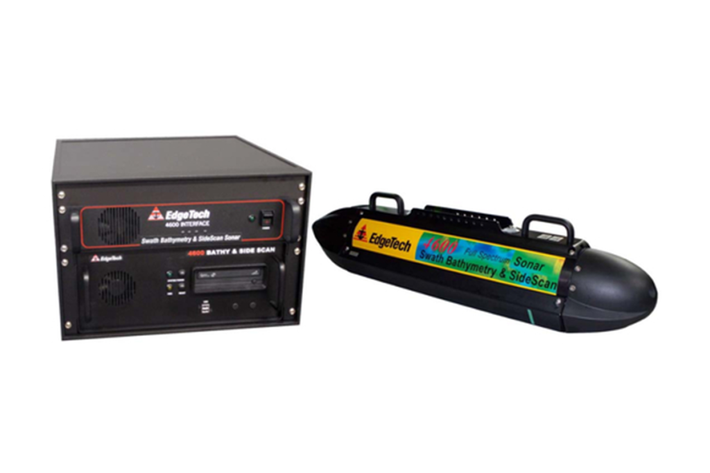
- EdgeTech 4600 Swath Bathymetry and Side Scan Sonar
- Eclipse Multibeam Sonar
- Odom MB1 Multi beam echo Sounder
- An EdgeTech 260 digital Sub bottom profiler
- 4125- P Edge Tech Side Scan Sonar
- S.G Brown Meridian Gyro compasses
- 100 / 600 khz J W Fisher PC based Side Scan Sonar
- A proton 3 JW fisher Magnetometer
- SeaSP Marine magnetometer
- Valeport 106 modern current meter
- G882 scission geometrics magnetometer
- Odom CV100 Echotrack Echo Sounder
- Odom dual frequency hydrotrac Echo sounder
- Hyropro navigational softwear
- Hydropro for badge/tug management
- C-Nav dgps Positioning System
- Sertels telementry for tug management
- Trible telemetry for tug management
- HP Draft Plotter
- Underwater video camera
- Fluxgate compasses
- Davit
- Gravity corer
- Grab sampler
- Wind velocity anemometer
- SSE trimbles GPS units
- Autocad software
- Micro-station software
- Sector Scan 650 JW Fishers
- TSS Dynamic Monitor Sensor DMS- O5
- TSS 320B Heave Compensator
- Sound velocity profiler
- A frame
- Trimble MS 750 GPS
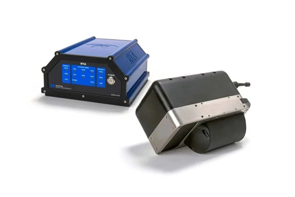
MB1 Multibeam
MB1 Multibeam echo sounder is a portable, easy to use bathymetric system that is designed to collect swath bathymetery using acoustic means. It has an operating frequency of 170KHz to 220KHz with range resolution at 3.6cm.
Unequalled images
20-30 dB improved SNR
Tow vehicle
Sub Bottom Profiler
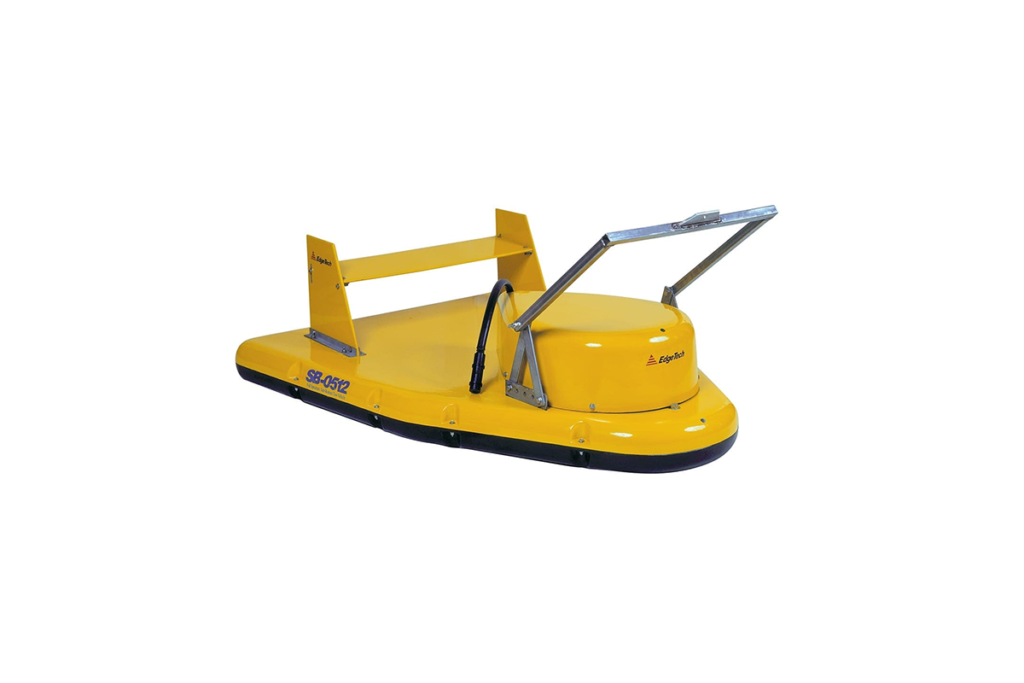
This sub-bottom profiler is EdgeTech’s providing Full Spectrum (“chirp”) imaging systems to customers who need the best in underwater acoustic imaging. Under any conditions when compared to other sub-bottom profilers, EdgeTech provides better images, more deployment options, and interface flexibility.
The 3200-XS system uses special design transmitters with low Q wideband characteristics best suited for “chirp” transmissions. If conventional off-the-shelf transducers are used then there is a need to compensate in software for the narrow band characteristics of the transmitters. At least two hydrophones are installed in the tow vehicle to reduce acoustic scattering from the sides. This results in a narrower across track beam pattern.
EdgeTech separates the Full Spectrum signal processing and the signal amplifier out into separate housings. This lets a user interface to his own or a 3rd party topside display processors for command, control, display, printing and data storage.
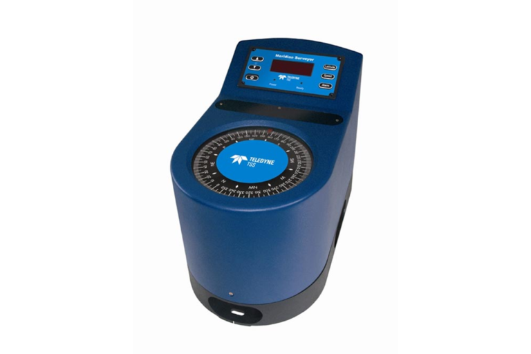
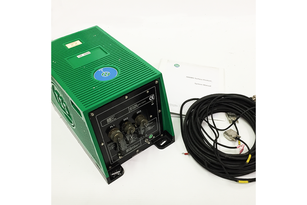
Gyro, Surface TSS Meridian
The SG Brown Meridian is an accurate Gyro Compass, which is easy to use, and simple to integrate into navigation systems. Outputs include RS232, RS422, 20mA Current Loop, Stepper and Synchro. Latitude and Speed compensation can be entered either by the top panel controls or from a navigation computer via the RS232 interface.
RS232 Output
24V DC Supply
Speed & Latitude Compensated
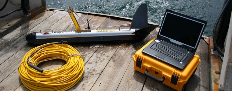
Dual Frequency
High definition of seabed contacts
150m light weight tow cable
Side Scan Sonar , EdgeTech
The Dual frequency 100K/600K side scan sonar for locating objects on the ocean floor. The 600K single frequency side scan is ideal for law enforcement and dive rescue operations because of its very high resolution over ranges up to 200′(400′ swath). The higher frequency can show targets that lower frequency (100K to 300K) systems have difficulty detecting. The limitation of the 600K system is shorter range as compared to lower frequency side scan. However, the higher resolution of the high frequency is ideal when searching for small targets. The 100K single frequency system is best for wreck hunting or general searchpplications. It has excellent longrange capabilities of up to 1,800′ per side (3,600′ swath). The dual frequency (100K/600K) side scan gives the operator the best of both systems. It allows 600K operation (very high resolution) when searching for small or soft targets and 100K operation when searching for larger targets or covering wide search areas. A 17″ wide thermal printer provides a detailed picture of the ocean floor and profile images of any object laying on the bottom.
The Valepor 560
The Valeport 650 sound velocity profiler directly measures the speed of sound using the digital “time of flight” method providing mm/s resolution. Pressure is measured using a strain gauge, and temperature is measured with a fast response Platinum Resistance Thermometer. Data can be stored in the internal 8MB memory, or can be displayed in real-time using the supplied Windows Datalog 400 software. Stored data is also downloaded with this software over a standard RS232 link. Recordings and readings can be depth or time triggered, continuos or burst sampled, or conditional sampled on a specific parameter.
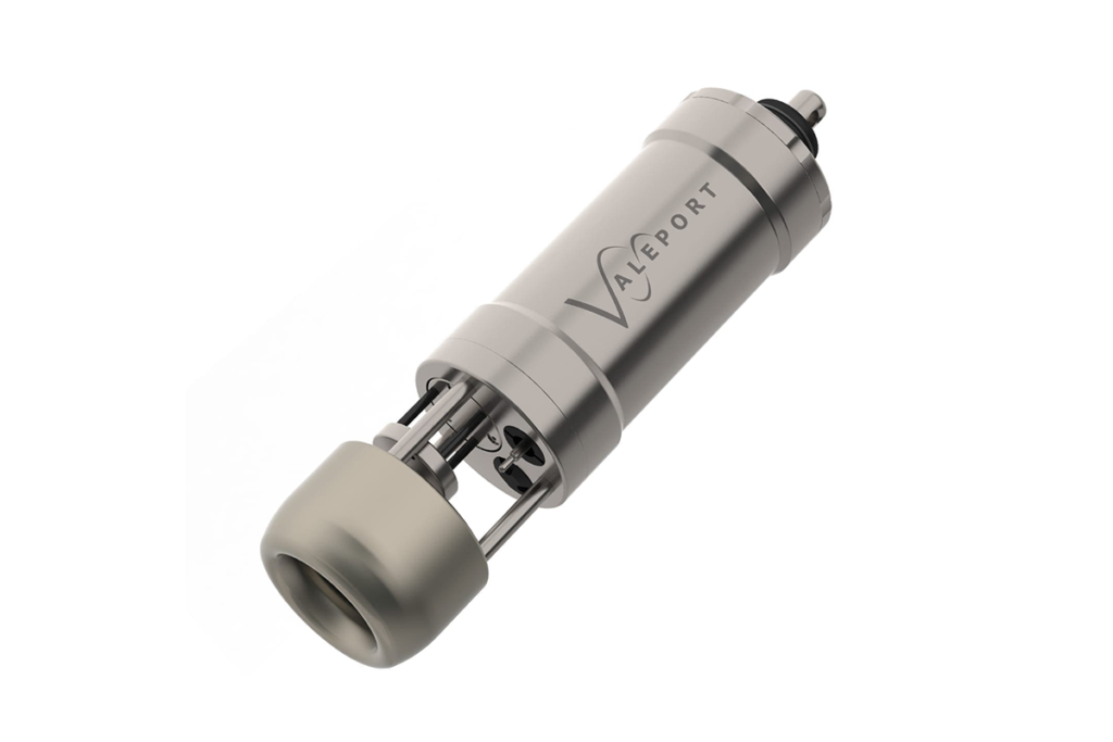
True SV Measurement
Self Recording/Direct Reading
5000m Rated
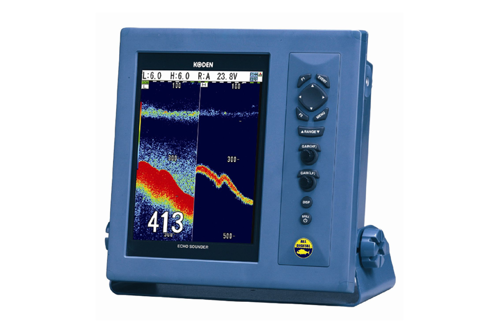
Portable Survey Echo Sounder
Dual frequency operation
30/200 KHz
Thermal recorder
Sediment Classification
Echo Sounder
The HydroStar 4300 is a well proven single beam survey grade echo sounder, available as a single frequency sounder with a 200 KHz transducer, or as a 30/200KHz dual frequency sounder. For dual frequency operation, only one transducer housing containing two elements is supplied. The maximum water depths achieved with the single frequency unit is 80m and 1000m with the dual frequency option. The HydroStar 4300 provides heave compensation and sound velocity correction with enhanced digital signal processing for reliable bottom detection and automated chart annotation
Positioning, C-Nav
Fem Associates utilises the C-Nav system from C&C Technologies to provide the very latest in technology for our position systems. C-Nav is a totally new concept in GPS positioning, providing world-wide horizontal accuracy on the order of 10 cm. C-Nav is based upon Real Time Gypsy (RTG) technology developed by NASA’s Jet Propulsion Laboratory (JPL) to provide centimetre-level accuracy for space applications. Traditional pseudo-range DGPS systems calculate offsetting ‘corrector’ values in an attempt to solve for inherent GPS measurement errors. Unfortunately, DGPS pseudo-range values become less valid as the distances from the reference sites increase. This is known as ‘spatial decorrelation’. C-Nav does not suffer from the effects of spatial decorrelation. C-Nav’s positioning is just as accurate in the world’s oceans as in the world’s ports. A single RTG subscription service, combined with C-Nav hardware, can provide you with world-wide positioning capability on the order of 0.1 meter.
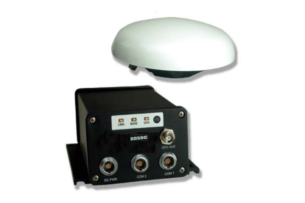
Global decimetre-level accuracy Fully automatic acquisition of satellite broadcast corrections.
Dual Frequency Antenna.
Configurable for global L-band satellite coverage – StarFire, WAAS, EGNOS.
Single, integrated package – simple installation. Rugged, waterproof, and dust resistant housing. Wide-range (10-40 VDC) power supply.
Serial Output
Analogue Output
IHO Standard
Motion Sensor
The TSS Motion sensor has been developed to work with a wide range of modern single beam echo sounders allowing real time heave compensation. Providing heave data in analogue and digital form, the outputs of the HS50 are easily configurable via PC terminal program. In addition to echo sounder compensation the HS50 is ideally suited to a wide range if offshore applications including crane and winch control, wave radar and ship motion measurement
Vale Port Current Meter
Description
Vale Port current meters model is an impeller – based meter measuring speed and direction, with optional temperature and depth parameters
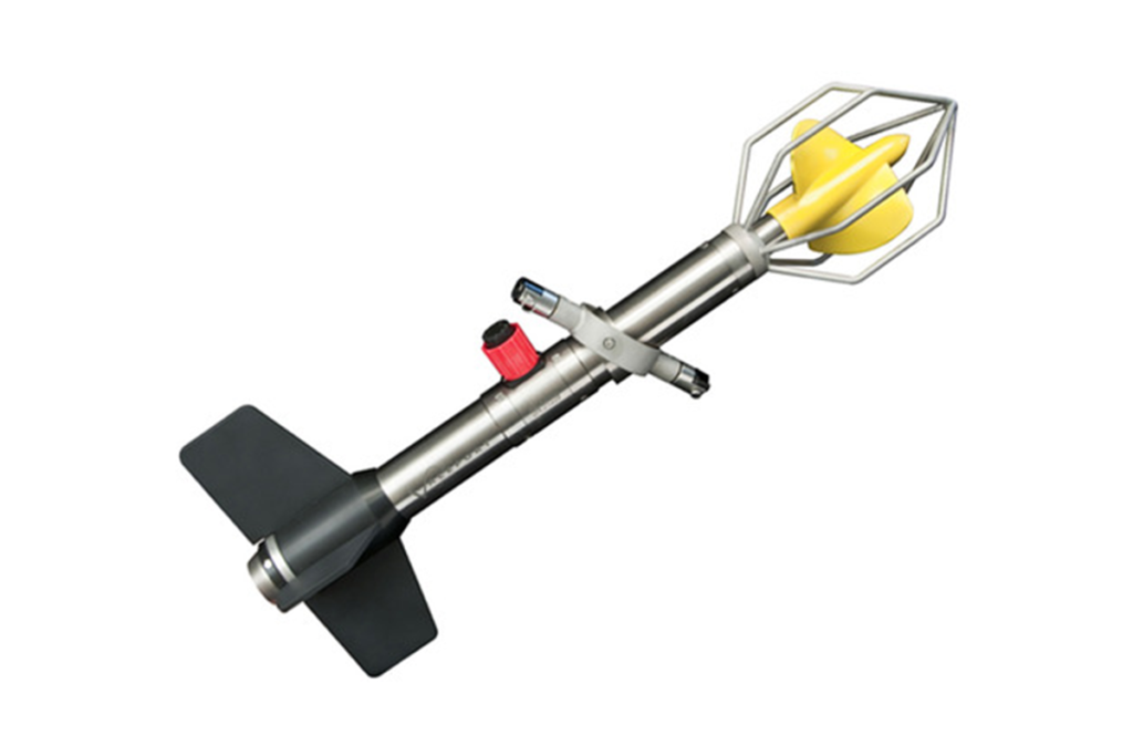
106 model
Speed and direction
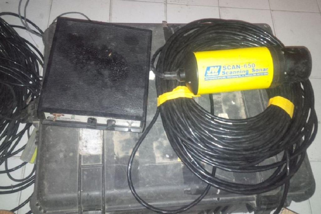
Frequency of operation is 650 KHz
Input voltage is 9-18 VDC or 120 VACDepth of 300m
Scan -650, Sector Scan
Sector Scan is a high performance imaging sonar system available in two different package configurations which enable it be used on large or small ROVs. It can also be pole-mounted and used from a small boat in shallow water
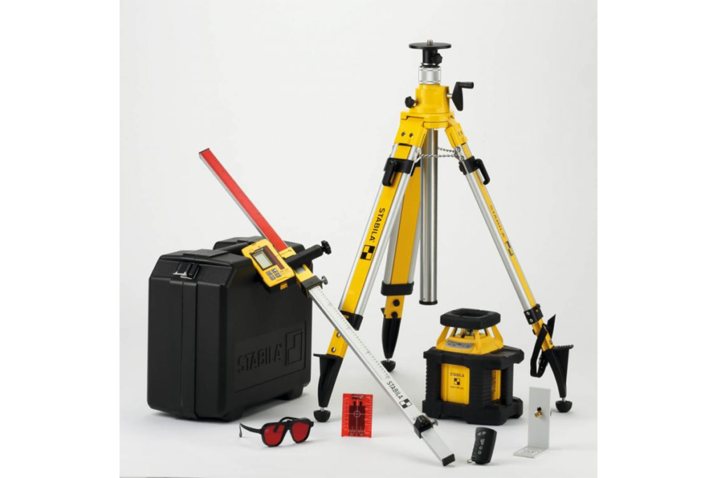
Leveling equipment
Vale Port current meters model is an impeller – based meter measuring speed and direction, with optional temperature and depth parameters
106 model
Speed and direction
Frequency of operation is 650 KHz
Input voltage is 9-18 VDC or 120 VACDepth of 300m
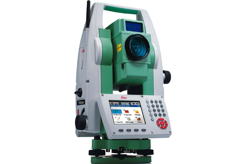
Total Station
The EdgeTech 4600 is a sophisticated marine survey system combining swath bathymetry and side scan sonar capabilities. It delivers detailed seafloor depth measurements and high-resolution underwater imagery, making it ideal for comprehensive seabed mapping, environmental monitoring, and underwater exploration. Its dual-function design enhances data accuracy and provides valuable insights into complex marine environments
EdgeTech 4600 Swath Bathymetry and Side Scan Sonar
The EdgeTech 4600 is a cutting-edge marine survey system that combines swath bathymetry and side scan sonar capabilities. Operating at 650 kHz, it provides high-resolution seafloor depth measurements and detailed underwater imaging. With a depth range of up to 300 meters and versatile power options (9-18 VDC or 120 VAC), it’s ideal for accurate seabed mapping and environmental monitoring
